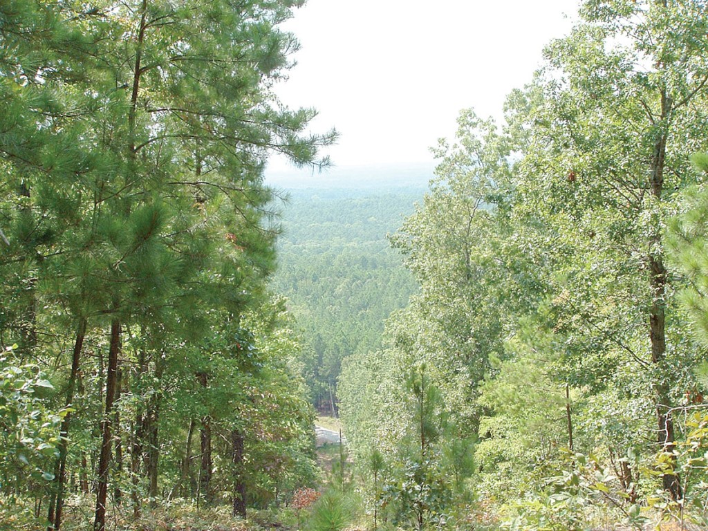
A 93-mile trek through Greenwood to Abbeville will take you to the Long Cane District where a geographic anomaly revives memories of Oconee and Pickens County vistas. Parson’s Mountain, a monadnock, sits alone overlooking the forest below as it stretches to the horizon. Geologists call this type of hill a “monadnock,” which is a technical term for a mound of hard rock left when all the surrounding land erodes away. It towers 832 feet over the Sumter National Forest. It’s a tough, winding climb to the top but worth it. Peering through the green canopy of broad-leaved, deciduous trees, the earth drops away into blue haze. It’s especially beautiful when fall colors arrive.
Dreams of El Dorado died on this rugged mountain. Feel up to a challenging climb? Take the spur that branches off the westernmost portion of trail and you will climb past Civil War-era gold mines to the summit. I made the climb. Up top stands a fire tower and I found a strange arrangement of stones that appear to be a compass. Stones spell out “N.” You’ll find an upright toilet in the woods just behind the tower. Use at your own risk.
Growling engine sounds float up through the canopy . . . more than 12 miles of off-road trails crisscross the mountain’s flanks. Come fall, fluorescent orange will dot the greenery along the Morrow Bridge and Midway Seasonal Camps as hunters arise and go forth.
From the top of the mountain you get a great view of the mixed pine and hardwood forests of the Piedmont. It’s quiet atop Parson’s Mountain, though a diamondback rattler rustled tall grasses right by the trail leading to the top. My walk down was much faster.
Nearby is the Parson Mountain Lake Recreation Area. A calm, 28-acre man-made lake distinguishes the wooded land. It’s a picturesque area with a 23-acre campground devoted to tent and trailer camping. People like to hike and fish here. Fishermen come here to catch bass, crappie, bream and catfish. Wading birds, including great blue heron, frequent the lake. A good-size picnic area sits near a swimming area (no lifeguards on duty).
The area offers relaxation and solitude as well as easy access to a variety of recreation activities. The day use area was designed with an earthen pier, a pedestrian bridge and a boat ramp for non-motorized boats.
Before you go, inquire to see if the area is open. It’s open seasonally from May 1 through Nov. 15. Even if the area is closed, it’s worth the drive to see how Parsons Mountain rises above the land, a mountain seemingly left behind by the Blue Ridge Mountains.
If You Go …
454 Parson’s Mountain Road
Abbeville, S.C. 29620
864-446-2273
• From Abbeville go south on Route 72 to South Main Street; turn left and look for signs.
Open from 9 a.m. to 9 p.m. during daylight saving time
• $3-day use fee per vehicle. $7 per campsite per night. Self-serve fee station. Campsites are first come-first served.
• GPS coordinates: GPS: 33.80497, -81.931278
• www.fs.usda.gov/recarea/scnfs/recarea/?recid=47187
Learn more about Tom Poland, a Southern writer, and his work at www.tompoland.net. Email day-trip ideas to him at [email protected].


